Energia Geotermalna
Na całym świecie obserwujemy rosnące znaczenie odnawialnych źródeł energii
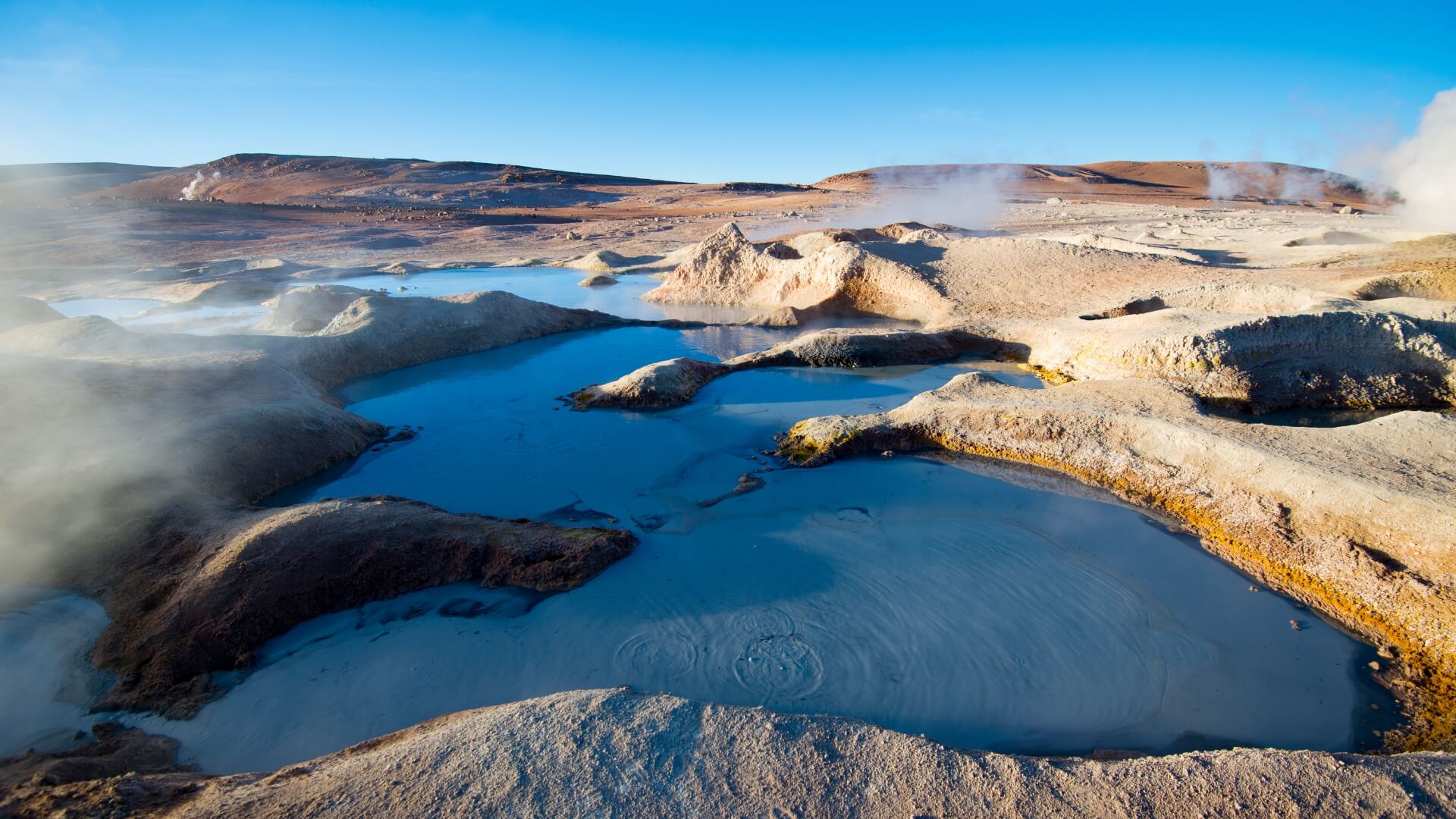
Energia odnawialna może stanowić ważną część miksu energetycznego. Zasoby geotermalne są niezawodnym źródłem energii, a także ekologiczną alternatywą dla paliw kopalnych, takich jak węgiel.
Poziom zrównoważonej produkcji zasobów geotermalnych wzrasta wraz z rozwojem metod poszukiwawczych. Dogłębne odwzorowanie geologii obszaru objętego badaniem oraz jej dopasowanie do otaczającego regionalnego środowiska geologicznego i tektonicznego ma kluczowe znaczenie dla zrozumienia danego systemu geotermalnego. Faza poszukiwawcza inwestycji geotermalnej ma na celu zlokalizowanie złóż geotermalnych, a co za tym idzie wybór najlepszych lokalizacji dla wiercenia otworów produkcyjnych.
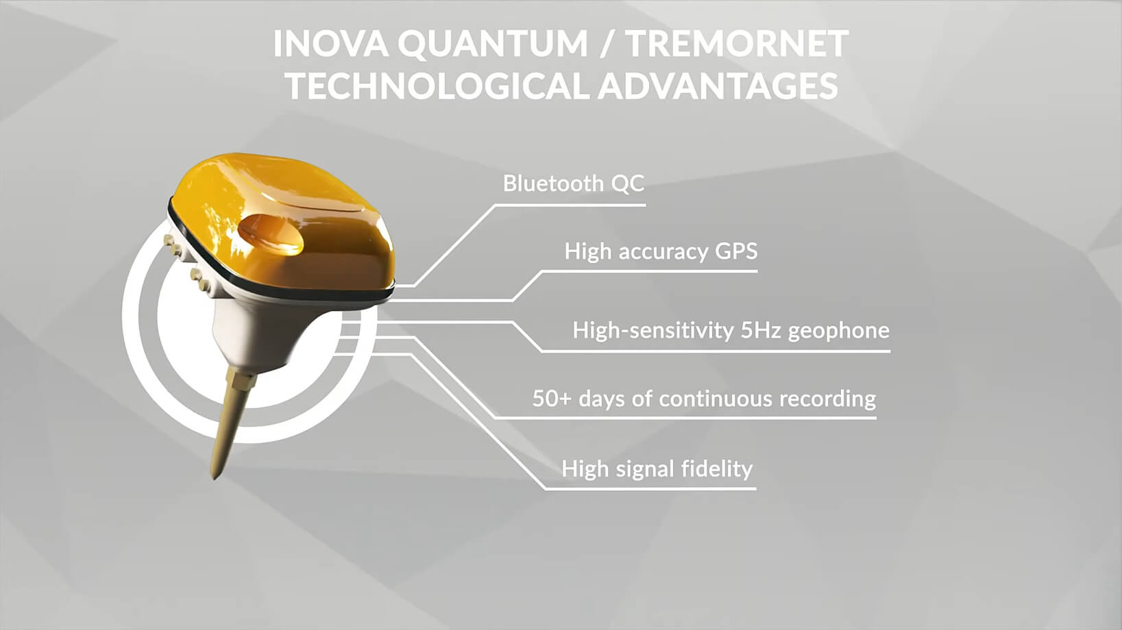
Poszukiwania złóż geotermalnych wiążą się ze znacznym ryzykiem, wynikającym z nieznajomości wgłębnej budowy geologicznej. Kluczowym elementem każdej takiej inwestycji jest więc właściwa lokalizacja instalacji geotermalnej, która gwarantowałaby odpowiednie parametry hydrogeotermiczne ujęcia wody. Pomiary sejsmiczne to najskuteczniejsza metoda rozpoznania złóż wód geotermalnych. Zasadniczym jej celem jest poznanie ścieżek przepuszczalności, które przenoszą płyny termiczne z ich głębokiego źródła do płytszych części systemu, gdzie można je w ekonomicznie opłacalny sposób wykorzystać do produkcji energii. Badania geofizyczne pomagają znacząco zwiększyć zrozumienie stratygrafii, struktury i przepływu ciepła. Metody sejsmiczne badają fale sprężyste, które zmieniają swe prędkości podczas przechodzenia przez różne rodzaje skał i są załamywane lub odbijane w nieciągłościach w formacjach lub pomiędzy nimi. Badania sejsmiczne dostarczają informacji na temat gęstości formacji, jej porowatości i tekstury, granic i nieciągłości, a także stref wypełnionych płynem, a tym samym nawet danych w zakresie temperatury.
Badania sejsmiczne nie są jedyną metodą, wpływającą na powodzenie programu geotermalnego. Podczas wiercenia, gdy temperatury w odwiercie są silnie zaburzone przez cyrkulację płuczki wiertniczej i wstrzykiwanie zimnej wody do odwiertu, pomiary geofizyczne w otworach pomagają określić temperaturę i ciśnienie w złożach, a także dostarczają innych cennych informacji na temat lokalizacji warstw wodonośnych i ich względnej wielkości.